679 SOUTH ORLEANS ROAD
Owner Information
BOHANNON DOUGLAS B TRUSTEE &
BOX 2344
BREWSTER, MA 02631


Property Details
679 SOUTH ORLEANS ROAD is classified as a Single Family Residential (Cape).
The primary structure on this property was built in 1969. There are 1,931ft2 of built area within this property. There is 1,931ft2 of residential/living space within this property. This property is listed as having 8 rooms.
679 SOUTH ORLEANS ROAD is valued at $406,100. The land is valued at $127,100 and the structures are valued at $277,500. There is an additional valuation of $1,500 on this property.
This property is in Zone RM. Confirm with local Zoning Board authorities to ensure there are no overlays or other easements on this property.
The most recent deed for 679 SOUTH ORLEANS ROAD is recorded at the local registrar in Book 26142, Page 246. 679 SOUTH ORLEANS ROAD was last sold on Friday, March 9, 2012 for $1.
Assessment data from fiscal year 2022.
Flood Data
According to the FEMA National Flood Hazard Layer, this property does not appear to be in a flood zone. It may also be in an area not yet reviewed. Nonetheless, confirm this information prior to taking any action.
To view the flood hazards around this property, create a FEMA "Firmette" Map of the area around 679 SOUTH ORLEANS ROAD.
Broadband Internet Providers
| Provider | Type | Bandwidth (mbps) | |
|---|---|---|---|
| T-Mobile | Fixed Wireless | 25 | 3 |
| Comcast | Cable | 1000 | 35 |
| VSAT Systems, LLC. | Satellite | 2 | 1 |
| Viasat Inc | Satellite | 35 | 3 |
| Verizon New England Inc. | DSL | 10 | 1 |
| HughesNet | Satellite | 25 | 3 |
| GCI Communication Corp. | Satellite | 0 | 0 |
Broadband service provider data from December 2020.
Adjacent Properties
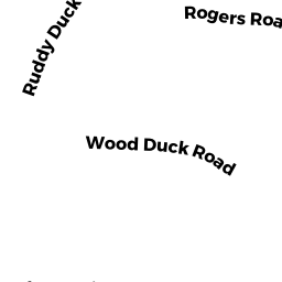
- 26 ROGERS ROAD
Single Family Residential owned by FOLEY DEVON R TRUSTEE - 0 CAPTAIN BURGESS ROAD
Vacant, Conservation Organizations (Charitable Org.) owned by BREWSTER CONSERVATION TRUST - 691 SOUTH ORLEANS ROAD
Single Family Residential owned by MAZZA LOUIS A & HELEN VLAGAS - 32 CAPTAIN BURGESS ROAD
Single Family Residential owned by FISCHER RICHARD STUART & - 10 ROGERS ROAD
Single Family Residential owned by O'LEARY KATHI ANN